 Polish Polar DataBase
Keyword
Digital elevation model, Dornier, Werenskioldbreen
Type of resources
Topics
Keywords
Contact for the resource
Provided by
Representation types
Update frequencies
status
From
1
-
1
/
1
-
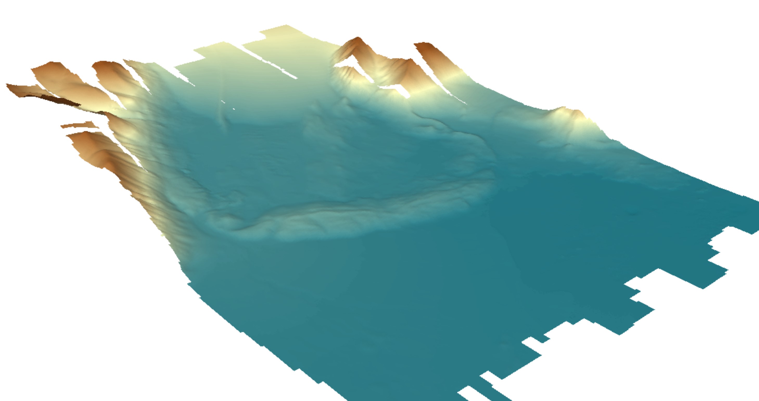
Digital elevation model (DEM) with high spatial resolution derived from aerial images captured in 2020 over Hornsund, Svalbard by Dornier aircraft. The spatial resolution of the orthomosaic is 0.174 m. Aerial images for the area were provided by the SIOS through a dedicated call of proposals (https://sios-svalbard.org/AirborneRS). The dataset is the supplement to the paper: Błaszczyk, M.; Laska, M.; Sivertsen, A.; Jawak, S.D. Combined Use of Aerial Photogrammetry and Terrestrial Laser Scanning for Detecting Geomorphological Changes in Hornsund, Svalbard. Remote Sens. 2022, 14, 601. https://doi.org/10.3390/rs14030601